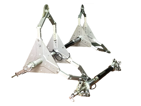
Our mapping probe is a sub-centimeter grade, gyroscopic based pipeline mapping system designed to accurately determine the XYZ location of underground utility pipes with an operational range of 1.5in ID to 58in ID.
Our probe identifies pipeline center-line geometry and bend radius as well as locating defects such as pipe sags, bellies, misaligned joints, and horizontal and vertical alignment in pipelines made of steel, concrete, PE, or PVC. We offer QA/QC of HDD Bores providing detailed reports, GIS data, & CAD drawings.

During the data acquisition process, we use survey grade GPS equipment to pinpoint the ends of the pipe segment into their 3D geospatial locations. Once we are tied into the grid, our probe is tethered back and forth from one side of the pipe to the other several times and each individual pass of the pipe is recorded to confirm repeatability of our findings. When the acquisition process is completed, we run a series of diagnostics on the data and are able to confirm the precision of our results before leaving site to assure the most accurate data is recovered. We take pride in being a full service and self-sufficient operation so once we get there, we have all of the equipment necessary to complete the task.
Our deliverables provide Northing/Easting or Longitude/Latitude and Elevation GPS coordinates with sub-centimeter grade precision at predefined intervals through the line so it is located to one specific point in the world regardless of what remains around it for the lifetime of the pipe. This technology and information is cross compatible across all utility networks so it can be used to map a specific pipeline or to build a master map of all pipeline/conduit locations within an area. Pipeline Owners, Construction Companies, and Municipalities can rest assured their pipeline infrastructure is known to be in the correct location and future generations will no longer need to search for days on end to locate utilities and can implement new infrastructure without fear of interference with old and unknown lines. With this technology, the exact location of the pipe will be permanently marked.
CASE STUDY
There are several instances in which knowing the exact location, shape, and profile of a pipeline may be useful. Confirming drilling results, verifying bend radius, mapping for future construction, or finding spots of potential losses in flow are just a few examples.
In this case, a contractor was made aware that they could potentially have a negative slope or "belly" in their active gravity flow waste line. They contacted us to run our Tethered IMU (XYZ Mapping) probe to locate the entire line in 3D space and determine if there were any such instances of negative slope or bellying across the line. If there were, our data would allow them to spot repair these specific sections of the pipe and prevent the need for digging out the entire line - something their CCTV technology was unable to achieve.
Upon conducting our initial run of the pipeline, most of the line was within spec. However, one pothole to pothole section showed an instance of a belly. We presented a length of pipe/elevation graph on site showing visual evidence of the belly at a specific distance from the start of the line as well as a full excel spreadsheet that included distance from the start of the line and full 3D coordinates of the line to allow them to precisely pinpoint the spot at which the belly appeared.

Upon reviewing our data, the contractor was able to locate and dig up this specific section of the pipe and make corrections. Once the spot repair was completed by the contractor, we ran our Tethered IMU (XYZ Mapping) Tool a second time to confirm the appropriate changes had been made. Our second run found that the belly in the line had been removed and the contractor was able to confirm that they were now within spec.


